
1 | 2 | 3 | 4 | 5 |
4. Bell and Back
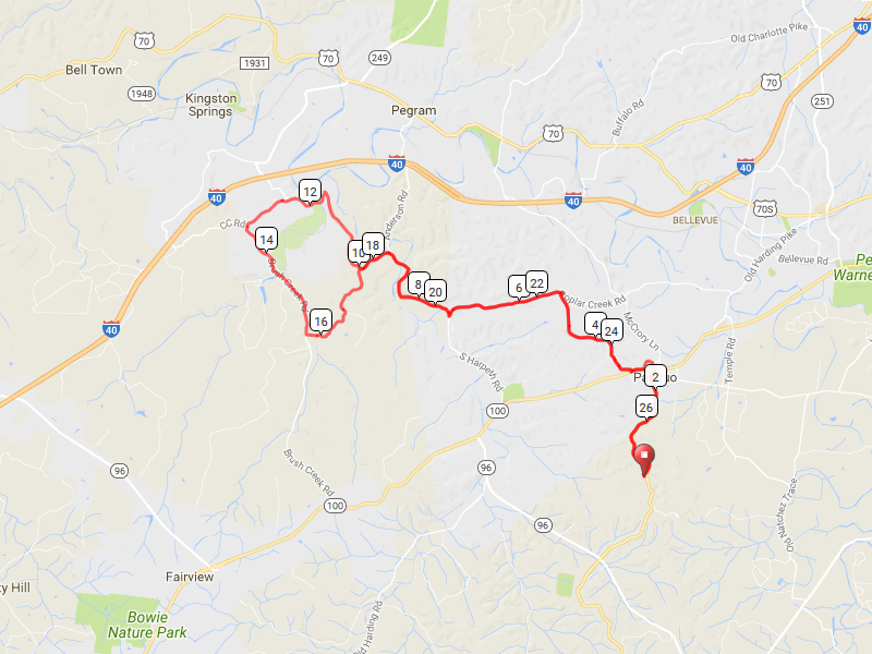
This ride takes you through the Natchez Trace and surrounding area from Kingston Springs to Fairview. It takes riders near Montgomery Bell State Park, hence its name. It starts and ends at Natchez Trace Mile 440 Parking Lot.
It is 27.3 miles long and goes up 2,323 feet and down 2,319 feet.
Map
Elevation Change

Route Instructions
| Leg | Dir | Type | Notes | Total |
| → | Right | Turn right toward Natchez Trace Pkwy | 0.0 | |
| 0.1 | ← | Left | Slight left onto Natchez Trace Pkwy | 0.1 |
| 1.5 | ↑ | Straight | Continue onto Natchez Trce | 1.6 |
| 0.2 | ↑ | Straight | Continue onto Natchez Trace Pkwy | 1.9 |
| 0.6 | ← | Left | Keep left at the fork, follow signs for Tennessee 100 W and merge onto TN-100 W | 2.5 |
| 0.5 | → | Right | Turn right onto Old Harding Pike | 3.0 |
| 0.2 | → | Right | Turn right onto Lewis Rd | 3.2 |
| 0.6 | ← | Left | Turn left onto Griffith Rd | 3.8 |
| 1.4 | ← | Left | Turn left onto Poplar Creek Rd | 5.2 |
| 2.1 | → | Right | Sharp right onto S Harpeth Rd | 7.3 |
| 1.9 | ↑ | Straight | Continue onto Anderson Rd | 9.2 |
| 0.0 | ← | Left | Slight left onto S Harpeth Rd | 9.3 |
| 3.1 | ← | Left | Slight left onto CC Rd | 12.4 |
| 0.9 | ← | Left | Turn left onto Brush Creek Rd | 13.3 |
| 2.4 | ← | Left | Turn left | 15.7 |
| 0.2 | → | Right | Turn right toward Forest Dr | 16.0 |
| 0.1 | ↑ | Straight | Continue onto Forest Dr | 16.1 |
| 0.6 | ← | Left | Turn left onto Webb Ridge Rd | 16.7 |
| 1.0 | → | Right | Turn right onto S Harpeth Rd | 17.7 |
| 0.7 | → | Right | Slight right onto Anderson Rd | 18.4 |
| 0.0 | ↑ | Straight | Continue onto S Harpeth Rd | 18.4 |
| 1.9 | ← | Left | Sharp left onto Poplar Creek Rd | 20.3 |
| 2.1 | → | Right | Turn right onto Griffith Rd | 22.5 |
| 1.4 | → | Right | Turn right onto Lewis Rd | 23.9 |
| 0.6 | ← | Left | Turn left onto Old Harding Pike | 24.5 |
| 0.2 | ← | Left | Turn left onto TN-100 E | 24.7 |
| 0.2 | ↑ | Straight | Take the ramp | 24.9 |
| 0.3 | ↑ | Straight | Merge onto Natchez Trace Pkwy | 25.2 |
| 0.5 | ↑ | Straight | Continue onto Natchez Trace Pkwy | 25.7 |
| 1.5 | → | Right | Slight right | 27.3 |
| 0.1 | ← | Left | Turn left | 27.3 |
Full interactive map and details.


